
Step 1: Find a map or a sign leading to a cool site like a tomb.
Step 2: Locate it.
Alternatively, locate said cool thing without any maps or signs showing you the way. Then you’re really winning.
My dreams of becoming Indiana Jones when I grow up are slowly crumbling as I realize I have zero skill as an archeologist. You might recall when we visited the stone monoliths and never saw any faces in the rocks. Well, today we went on a little road trip to Aimeliik, “the wettest spot in Palau.” We meant to visit a tomb and couldn’t seem to find the thing. Allow me to backtrack.
Palauans are very fond of burning things, and there are always random, controlled fires burning in the jungles, no big deal. Today though, there was one directly across the street and the wind blew all the smoke straight into our house, suffocating us. We escaped out the door as quickly as we could and went to the store to get bread, only to come back home to a cloud of smoke that hadn’t dissipated in the least.
Before we even got out of the car I asked Fletch if he wanted to go for a drive. His response, “Sure, but can we make some sandwiches first?” So he ran inside and came back a moment later with two tomato and cucumber sandwiches, drinks and chips. We were ready for a road trip!
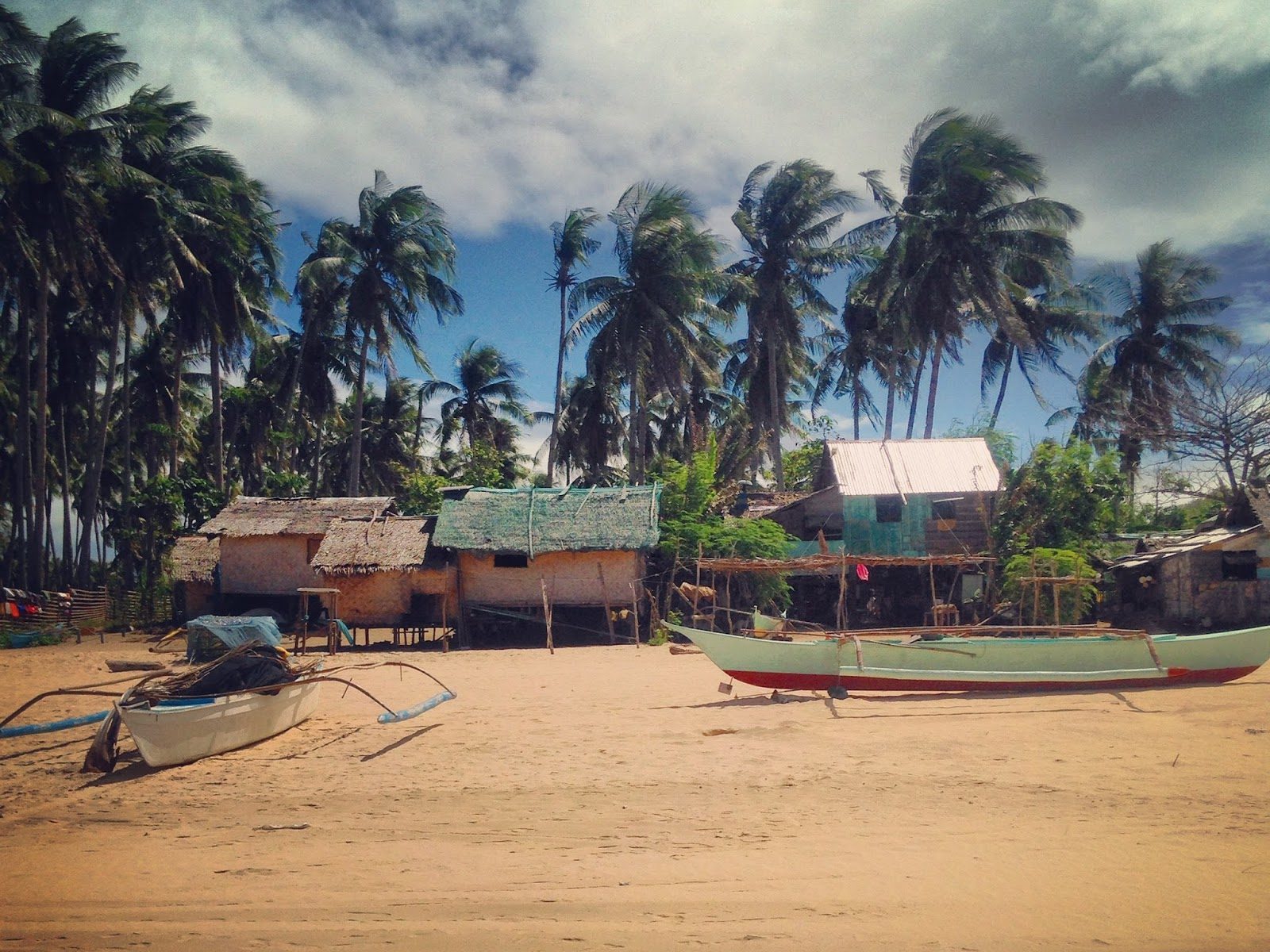
We drove towards Babeldoab and this time chose the clockwise direction around the Compact Road (the only named road in Palau and that’s the name they went with). With no destination in mind, we took the first left turn we came to, which led into Aimeliik state. Almost immediately, the compact road turned to dirt. The individual states have almost no motivation or desire to invest in paved roads.
Before too long we came upon a welcome sign that read:
Traditional boundary between hamlets of Ngerkeai and Imul. Cultural law dictated that should anyone break a law of one of the hamlets and is marked for death, once he crosses this boundary, he cannot be killed or injured by his pursuers.
That was slightly ominous. Especially as the road became smaller and smaller and the jungle became denser and denser. If anyone ever needed to hide a body, they’d just need to walk twenty feet away from the road. We joked about that but I got an uneasy feeling in my gut.
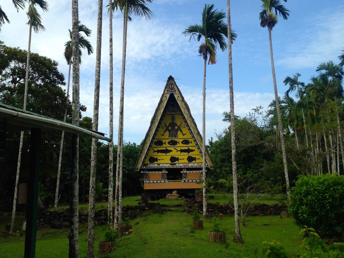
We drove by a clearing with a large wooden, painted building. This must be one of the traditional bais! I had heard about them, but had yet to see one.
 |
| Bai Rekeai, one of four standing bais in Palau. |
A bai is a traditional meetinghouse that used to be common here, with several existing in every village. It would be built upon a stone platform, and made entirely of wood besides that, without so much as a nail. Decorations on the front, back, and interior told stories, and were the only form of written history in Palau. There were two kinds of bai: the bai ra cheldebechel, which was a clubhouse, and the bai ra rubak, which was for tribal chiefs. Women were not allowed inside the latter.
I only learned today that the bais were basically sex houses as well, and I quote from our guide map,*
Bai ra cheldebechel was a schoolhouse where children were taught about fishing and carpentry, and also a place where young men had their first sexual experience. Young women from other villages were brought in in exchange for money and beads. It was considered an honor to serve as a bai woman. If they became pregnant, then that child became the child of the chief, and the woman and the child received support and status. A typical bai only lasted around 50 years in the tropical climate, before it needed to be rebuilt.
 |
| I have a pretty good guess which kind of bai this was, based on the painting. |
We were wondering why there was a woman with boobs hanging out and legs spread painted on the front of the bai. I guess that explains it. There was supposed to be a $10 entrance fee but no one was there to collect it and there was caution tape roped across the two stairs leading up the hill. We could have easily walked around but decided it would be respectful not to.
On with the road trip.
We came to a fork in the road with four signs pointing in each direction. Aside from a handful of Palauan words we couldn’t make out, we saw Terraces and Power Plant to the right, and Malsol’s Tomb to the left. We drove left.
The road kept getting smaller and smaller until we had to drive through some loner wearing a security t-shirt’s backyard to continue. Finally we saw another sign with Malsol’s Tomb pointing to a staircase on the right side of the road. We pulled over and hiked two stories of stairs up the hill to investigate.
At the top of the staircase we found a sign with the unfortunate story of Malsol.
Malsol was known as the bravest warrior in Ngermlengui. One day, Malsol made an enemy of a woman named Dirrengulbai. Some say they became enemies because Malsol murdered the woman’s brother. Others contend that he merely insulted the corpse of her brother. Regardless, the woman swore she would exact her revenge upon Malsol. After careful thought, Dirrengulbai devised a plan. Her first step was to marry the paramount chief of Melekeok, Reklai. Following their marriage, Dirrengulbai refused to sleep with her new husband. When he asked her what was wrong, she told him about Malsol. Her new husband then asked Bekeu ‘I Bechab, a warrior from one of the villages to hunt for Malsol and bring him to the woman for punishment. Eventually the warrior discovered Malsol near a lagoon. The two men began fighting in the warrior’s canoe. The warrior was armed with a bracelet weapon made of shark teeth called a “chereall,” which he used to cut Malsol’s abdomen open. As instructed by the chief, the warrior took the badly wounded Malsol to the woman who was waiting in Elechui village in Aimeliik. The woman spat in Malsol’s face and ordered the assembled women of the village to stone Malsol to death. These same stones now make up the tomb in which Malsol is buried.
So I guess that whole not being able to pursue a condemned man over the border rule didn’t work out too well for poor old Malsol.
The sign itself was erected on a mound of rocks, and a little ways away there was a stone pathway leading off into the jungle. Surely the tomb was at the end of the path.
 |
| How to tempt someone into the jungle to steal their kidneys at the end… |
So we hiked our way through the jungle on a path that obviously hadn’t been used in a very long time. The stones were rounded and very inconvenient to walk on. Halfway along, there was an entire group of trees that had fallen over, blocking the way. We carefully made our way around those and continued quite a ways until we found ourselves in a clearing with four very modern-looking graves. None of them looked like a pile of stones used to stone a man. Two were nothing but mounds of dirt covered with a panel of aluminum roofing. One was a headstone. One was a rectangle made up of concrete blocks. One of the aluminum roofs had several arrays of fresh flower arrangements set over it.
That couldn’t be the ancient tomb. Bizarre.
We looked around to see if the path continued anywhere else. We were at a dead end in the middle of nowhere.
So we hiked back through the jungle, growing uneasy at every little sound we heard. At one point there was a loud hiss that sounded like a large, angry cat. I don’t believe there are any large cats that live here but the sound made me wonder. Finally, we once again came to the sign. We investigated the mound of stones it was erected on top of once more. Was that the tomb? We walked around the rest of the clearing several more times. Nothing matched the description on the sign of a mound of rocks 2′ x 5′ x 12′. Clueless and confused, we got in the car and left.
We drove back to the fork in the road and followed the sign for the terraces. All along the road we saw lovely green terraced hills, the closest thing to any landscaping I’ve seen on Babeldoab (aside from the president’s wife’s red trees planted alongside the Compact Road). Apparently this landscaping was pretty ancient though. The sign read 2200 – 1000 years BP (before present?). That was back in the days when the population of Palau was said to be around 100,000. According to the World Heritage Centre, some terrace complexes are sophisticated systems that may have been variously used for agriculture, settlement, defense, and ceremonial functions.
We climbed to the top and reveled in the view.
 |
| View from the top of Ngebedech Terraces. |

And thus concluded our road trip. I learned that bais were every boy’s favorite building. I learned that I would make a horrendous archeologist. And I stood on what was probably once an ancient lookout.
*Franko Maps, Republic of Palau, Adventure & Dive Guide, Guide to the Undisputed Best Diving in the World. Available on Amazon.com.

Anonymous
I m French, I read your adventure. It remind me my two trips to Palau.
Thank you.
Nicolas Cortyl
Lexi
Thanks for reading!